ABOUT
LAKE WINNIPESAUKEE NH

There are 240 miles of shoreline according to some;
183 miles according to others.
There are 365 islands, of which 274 are habitable.
Surface area is 72 square miles.
The lake is 9.5 miles wide and 28 miles long.
It is 504 ft above sea level.
It’s the largest lake in New Hampshire.
There are 240 miles of shoreline according to some;
183 miles according to others.
There are 365 islands, of which 274 are habitable.
Surface area is 72 square miles.
The lake is 9.5 miles wide and 28 miles long.
It is 504 ft above sea level.
Deepest part of the lake – 180 ft, southeast of Rattlesnake Island.
The rest of the lake is between 20-100 ft deep.
Rattlesnake Island has the highest elevation of 400 ft.
Lake Winnipesaukee in New Hampshire freezes over early to mid January.
There are eight cities and towns that border Lake Winnipesaukee – Alton, Center Harbor, Gilford, Laconia, Meredith, Moultonboro, Tuftonboro and Wolfeboro.
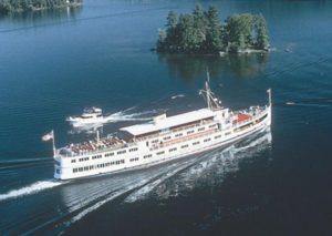
Facts on ice out – Official ice out is when the M/S Mount Washington can reach all four of its ports without touching ice.
The smallest Island – Becky’s Island which is about 10 feet wide depending on water level.
The largest Islands – Long Island (which has a bridge to it) and Bear Island.
Lake Winnipesaukee has three islands with the same name – all are called Loon Island.
Nineacres Island actually has 13 acres.
Stonedam Island has a wildlife preserve that can only be visited by boat.
Cow Island is sometimes called Guernsey Island – The island was once used to quarantine cows brought from Europe.
Wolfeboro is the oldest summer resort town in the US.
There are over 273 lakes and ponds in the lakes region of New Hampshire.
Facts on the number of islands that can be reached by bridge – six; Black Cat Island, Long Island, Oak Island, Governor’s Island, Worcester Island and Christmas Island.
Islands measured from Center Harbor – Mile Island, Three-Mile Island, Five-Mile Island and Six-Mile island.
There are 75 numbered buoys: 1-31 and 39-83.
Facts on the red and white buoy – proceed on the south and west side.
Facts on the black and white buoys – proceed on the north and east side.
The area between Deven’s Island and Little Bear Island is sometimes referred to as “Hole in the Wall.”
Birch Island and Steamboat Island are the only two islands connected by a bridge.
“Sally’s Gut” is a passageway for boats between Stonedam Island and Meredith Neck.
“The Witches” is a rocky area east of Governor’s Island. These rocks are normally just below the surface and extremely hazardous to boaters.
Weirs Beach got its name from the native Indians. A long time ago, natives built a basket, call a weir, to catch fish (Shad) that migrated through the Weirs channel.

